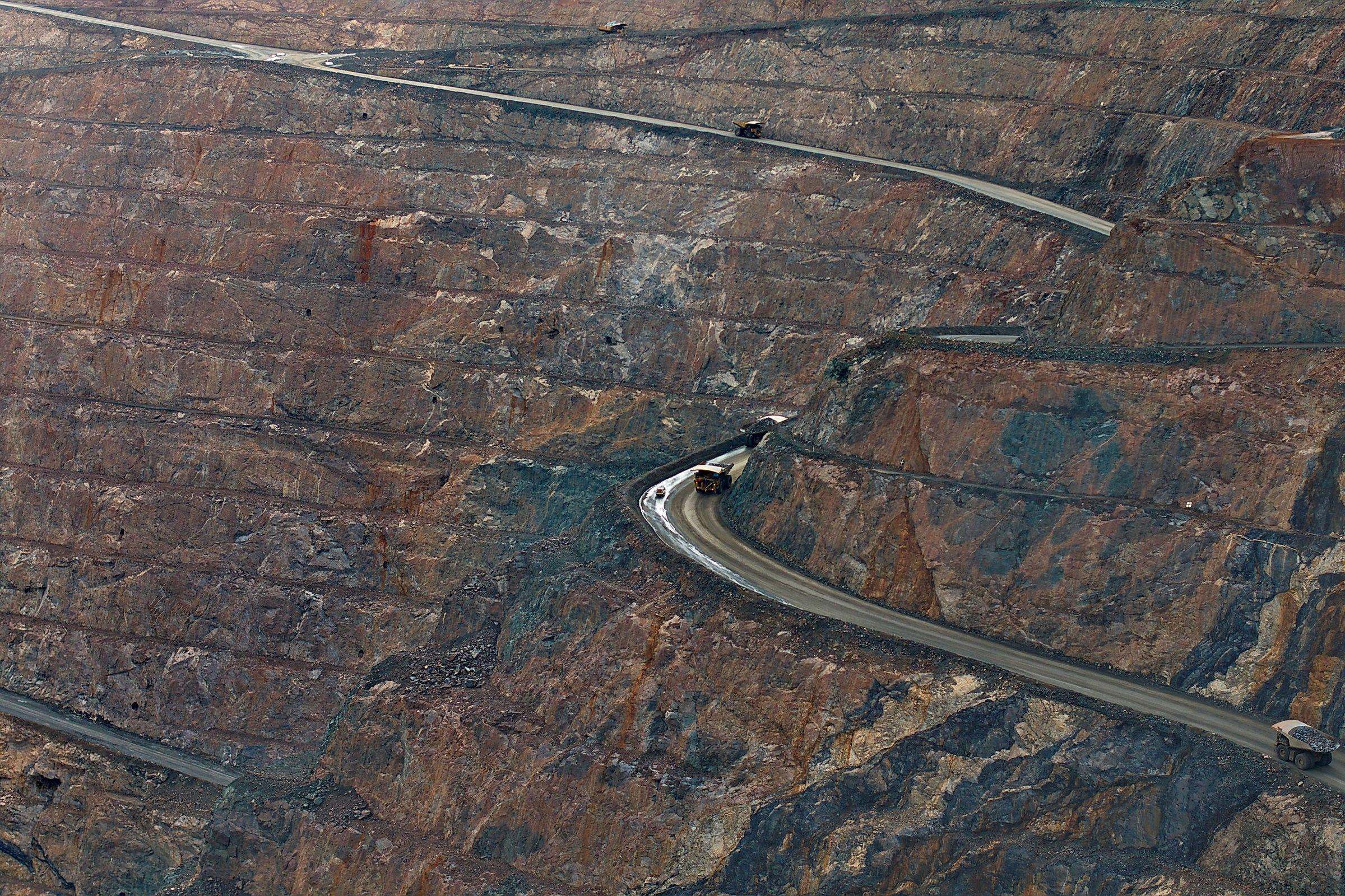
Drones in surface mining: stockpile survey, blast monitoring and settling basins
What drone surveying actually delivers in quarries and open pits: stockpile volumes, highwall mapping, blast monitoring and settling basins, and where the responsibility of the mine surveyor begins.
In quarries and open pits, the drone has become an ordinary survey instrument. It flies a stockpile, a bench or a settling basin faster than a crew on foot and it does so without sending anyone onto loose material. What it does not do is change who is legally responsible for the mine survey record. This article sets out what aerial survey delivers in surface mining, what limits the site itself imposes, and how the operation fits into European drone regulation. wedrone is the drone unit of werob. It does not fly itself and holds no aviation certificates of its own; flights are carried out by approved partner operators.
Key Takeaways
- 1With ground control, drone photogrammetry reaches the centimetre range, which is sufficient for stock reconciliation and progress tracking.
- 2Repeatability matters more than absolute accuracy: campaigns flown identically can be subtracted from one another, campaigns flown differently cannot.
- 3Section 64 BBergG is a documentation requirement for the mine survey record, not a measurement monopoly. Aerial survey changes the frequency; the record and the responsibility for it remain with the Markscheider.
- 4Site conditions set the limits: blast lockout periods, dust degrading photogrammetry, and haul roads for large equipment determining where launch and recovery are possible.
- 5Since 29 September 2025, SORA 2.5 has been the binding AMC under Regulation (EU) 2019/947. There is no PDRA for BVLOS over populated areas, and of 496 active BVLOS authorisations across 11 member states only 89 are regarded as economically viable.
- 6The German aggregates industry association MIRO reports around 2,700 plants in some 1,600 companies, roughly 23,000 employees and just under 500 million tonnes of aggregates per year.
Stockpile survey: what photogrammetry delivers and what it depends on
Stockpile survey is the application that brought drones into most quarries. The classical method sends a surveyor across the pile with a GNSS rover, walking a grid of points that is only ever as dense as time and footing allow. On steep, loose or freshly tipped material, footing is exactly the problem. An aerial survey covers the same pile from above with hundreds of overlapping images, from which photogrammetric processing derives a dense point cloud and a surface model.
Accuracy is the question that decides whether the result is usable. With properly distributed ground control points, or with an RTK or PPK positioning solution and a smaller number of check points, photogrammetric surface models reach the centimetre range. That is sufficient for stock reconciliation, for tracking extraction progress and for the internal reporting that sits on top of it. It is not a substitute for a geodetic control network and it should not be presented as one.
The more important property is one that is easy to overlook. What makes a survey series valuable is repeatability, not absolute accuracy. Two campaigns flown to the same profile, with the same altitude, the same overlap, the same camera settings and the same control points, can be subtracted from one another, and the difference volume is meaningful even if both surfaces carry the same systematic offset. Two campaigns flown differently cannot be subtracted in that way: part of the apparent difference is then a product of the flight, not of the material. Fixing the flight plan once and reusing it is therefore the single most effective quality measure available, and it costs nothing.
- Fix the flight profile before the first campaign and treat changes to it as a break in the series.
- Use permanently marked ground control points where possible, so that the reference does not move between campaigns.
- Record the state of the pile, not only its shape: freshly tipped material settles, and settlement is not extraction.
- Keep the raw imagery, because a reprocessing is only possible if the input is still available.
How wedrone structures such recurring campaigns with approved partner operators is described on the wedrone surface mining page.
Pit surveys, the mine plan and the role of the Markscheider
This is the point at which most vendor material becomes imprecise, so it is worth stating carefully. In Germany, mining operations subject to the Bundesberggesetz have to keep a mine survey record, the Risswerk. Section 64 BBergG is a documentation requirement attached to that record. It is not a measurement monopoly. It does not prohibit anyone from flying a pit, and it does not make a drone survey unlawful.
What it does mean is that the Risswerk, its content, its form and the responsibility for its correctness, remains with the appointed Markscheider. A drone campaign is a source of survey data that the Markscheider may use, under conditions the Markscheider defines and verifies. The honest formulation of the benefit is therefore narrow and defensible: aerial survey changes the frequency, not the responsibility. Where the statutory record was updated at the prescribed intervals, an operator can now hold a current surface model monthly or weekly for their own planning, without the record itself changing hands.
Both exaggerations should be avoided. Drone survey is not forbidden in mining, and it does not replace the Markscheider. Operators who present it as the latter tend to discover the mistake during the next inspection by the state mining authority.
Within that boundary, the operational value is real. A current surface model supports cut and fill calculation against the mine plan, verification of bench geometry and berm widths, planning of haul roads, and documentation of the worked area for internal purposes. It also gives the planning department something the classical survey interval rarely provides: a picture of the site that is only days old.
- Progress control: comparison of the current surface against the planned excavation state.
- Volume balance: extracted material against reported and dispatched quantities.
- Geometry check: bench heights, slope angles and berm widths against the approved operating plan.
- Documentation: a dated, reproducible record of the site condition for internal use, feeding the Markscheider's work rather than replacing it.
Before the blast: highwall mapping and burden
Face mapping is one of the applications where the safety argument is strongest, because the classical method requires a geologist to stand at the foot of a highwall to record joint sets and bedding. Close-range photogrammetry from a stand-off position produces a dense three-dimensional model of the same face without anyone entering the rockfall zone.
From that model, the structural information that matters for blast design can be extracted: orientation of joint sets, bedding planes and fault traces, spacing and persistence of discontinuities, and the actual geometry of the face including overhangs and irregularities that a nominal profile does not show. The last point is the practically relevant one. Burden is only correct if the real face geometry is known, and a face that has been assumed vertical but leans back locally produces exactly the excess energy that ends in flyrock or in a wall that is damaged behind the intended break line.
The geotechnical assessment of these findings remains an engineering task. The model shows where discontinuities run and how the face is shaped; whether a wedge is kinematically capable of failing, and what that means for the working area beneath it, is a judgement made by the responsible geotechnical engineer. The same applies to sequential comparison of surface models for deformation monitoring: the survey can show that a surface has moved, and it is the engineering assessment that decides what follows from that. The choice of aircraft and payload for this work is a question of dust tolerance, endurance and camera geometry rather than of brand; an overview of the equipment categories in use is available in the robot catalogue.
- Discontinuity mapping: strike and dip of joints, bedding and faults, extracted from the model rather than measured at the wall.
- Face geometry: actual profile per drill row as the basis for realistic burden values.
- Deformation tracking: comparison of surface models over time, within the limits of the accuracy the flight profile actually achieves.
- Documentation: a dated record of the face condition before charging.
After the blast: muckpile and fragmentation
After detonation, aerial imagery serves two purposes. The first is volumetric: a surface model of the muckpile gives its shape, displacement and swell, which supports loading planning and provides a check on whether the blast performed as designed. The second is optical fragmentation assessment, where image analysis derives a size distribution of the visible material.
The second application deserves a clear caveat. Optical fragmentation analysis measures what is visible on the surface of the muckpile, and the surface is not a representative sample of the whole. Fines are systematically under-represented because they sit between and beneath the larger blocks, and the result depends on image scale, lighting and the calibration used. Treated as a relative indicator between comparable blasts on the same face, it is genuinely useful: it shows whether a change in the drilling pattern or the charge moved fragmentation in the intended direction. Treated as an absolute grading curve for the crusher feed, it is not reliable, and published error margins from individual studies should not be carried across to a different site.
Aerial documentation of the blast event itself, from a safe distance and outside the exclusion zone, additionally supports the review of the initiation sequence and the identification of anomalies such as misfires that require a defined procedure before anyone re-enters the area. Here too the drone supplies the record; the decision to release the area remains with the blasting supervisor.
- Muckpile profiling for shape, displacement and swell as input to loading planning.
- Fragmentation assessment as a relative indicator across comparable blasts, not as an absolute grading curve.
- Documentation of the sequence and of the post-blast condition of the face for the blast report.
- Comparison of pre-blast and post-blast face geometry to evaluate wall damage behind the break line.
Settling basins and tailings facilities
Settling basins, tailings facilities and their embankments are the highest-consequence structures on most sites, and they are also the ones where regular, comparable condition data is hardest to collect on foot. Embankment crests are long, access is often poor, and the parameters of interest change slowly enough that a subjective impression from a walk-over is a weak instrument.
Aerial survey addresses this in a straightforward way. A photogrammetric campaign delivers a surface model of crest, slope and toe that can be compared with the previous one, which makes settlement, bulging and erosion channels visible as measured quantities rather than impressions. Volumetric calculation of the stored material and of the remaining freeboard becomes a routine result of the same flight. Thermal imagery can indicate temperature differences at the downstream slope that are worth inspecting more closely, and multispectral data can show where vegetation patterns change in a way consistent with persistent moisture.
The limitation is the same as everywhere else in this field: these are indications that direct an inspection, not seepage measurements and not a stability assessment. Piezometric levels, internal erosion and the stability of the structure are the domain of the responsible geotechnical engineer and of the instrumentation in the dam. The value of the aerial data lies in its regularity and comparability, which makes it a useful trigger for targeted inspection between the formal ones.
- Surface models of crest and slopes, compared campaign to campaign to detect settlement and deformation.
- Volume and freeboard as a routine by-product of the same survey.
- Thermal and multispectral indications of moisture, used to direct an inspection rather than to replace one.
- Erosion channels and surface cracking documented with a date and a position, so that development can be traced.
The regulatory frame for flying over an active site
European drone operations are governed by Implementing Regulation (EU) 2019/947 for the operation, with the categories open, specific and certified, and by Delegated Regulation (EU) 2019/945 for the equipment. Most survey flights over a fenced site can be planned in visual line of sight, but weight, flight geometry, proximity to uninvolved persons and adjacent roads or settlements can push an operation into the specific category quickly.
Where the specific category applies, the risk assessment follows SORA, and since 29 September 2025 version 2.5 is the binding AMC under ED Decision 2025/018/R. The changes are substantive: a quantitative iGRC model replaces the coarse ground risk table, the process is structured in ten steps, and Detailed Operational Information takes the place of the former CONOPS. Documentation written against SORA 2.0 has to be reworked.
Two clarifications that recur in this field: there is no PDRA for BVLOS over populated areas, the set remains S01, S02, G01, G02 and G03; and FAA Part 108 is not in force, it exists only as a proposed rule. In Germany, operational authorisations are issued by the Luftfahrt-Bundesamt, and the processing time depends on the case, so no blanket figure is meaningful.
On the airspace side, the U-space framework consists of Regulations (EU) 2021/664, 2021/665 and 2021/666, applicable since 26 January 2023. Uptake remains limited: San Salvo in the Abruzzo region is the first and so far only fully certified operational U-space airspace in the European Union. The economics are equally sober, with 496 active BVLOS authorisations across 11 member states of which only 89 are regarded as economically viable. For a quarry, the practical conclusion is to design the operation so that it stays within what is realistically authorisable, rather than to plan around a permit that may not arrive.
Alongside aviation law, the site's own rules apply. Mining supervision by the state authority, the operating plan under the Bundesberggesetz and the site's safety regime govern who may be where and when, and a flight permit is not an entry permit.
What the site itself dictates, and how the work is organised
The constraints that actually determine whether a drone programme works in a quarry have little to do with aviation law.
Blast lockout periods. On blast days the exclusion zone and the timing dominate everything else. Survey flights have to be scheduled around charging, the exclusion period and the release of the area, and a post-blast flight can only take place once the blasting supervisor has released the site. The survey plan follows the blast plan, never the other way round.
Dust. Photogrammetry depends on identifying the same surface point across overlapping images. Airborne dust from haulage, crushing, wind or a recent blast degrades exactly that, and the result is a noisy or locally unusable point cloud. Dust also settles on the material itself, which changes its appearance between campaigns. In practice this frequently means flying early in the shift, or waiting.
Haul roads and large equipment. Excavators, dumpers and mobile plant define where a launch and recovery site can be established and how far the aircraft must stay from moving machinery. The traffic pattern on the site, not the shortest walk to the pile, decides the take-off point, and this has to be agreed with shift management rather than improvised.
Against these constraints, the organisational question is whether an operator sets up an internal flight capability or contracts the operation. wedrone does not fly. It holds no operational authorisation, no operator certificate and no LUC. It specifies the survey requirement, sources suitable equipment on a manufacturer-independent basis, matches the requirement to approved partner operators who hold the necessary authorisations, and arranges the data flow into the operator's planning systems. The aviation responsibility, the operations manual and the accountable manager sit with the partner operator, and the mine survey responsibility stays with the Markscheider. Both boundaries belong in the contract.
The scale of the addressable market is easy to underestimate. According to the German aggregates association MIRO, the sector comprises around 2,700 plants in some 1,600 companies with roughly 23,000 direct employees, producing just under 500 million tonnes of aggregates per year. That is an association figure and should be read as such, but it indicates how many sites face the same survey question with very small technical departments.
Below ground the picture changes completely. There is no GNSS, navigation runs on SLAM and infrastructure-based positioning, communication is limited, and in firedamp-endangered workings ATEX equipment group I applies, which most commercial equipment does not meet. That domain belongs to ground robotics rather than aviation and is covered by werob under mining robotics, with a separate article on underground autonomous vehicles and inspection.
The same regulatory frame applied to a very different environment, with a moving deck instead of a haul road and no landing option at all, is described for offshore inspection.
FAQ
- How accurate is drone-based stockpile survey?
- With properly distributed ground control points, or an RTK or PPK positioning solution with check points, photogrammetric surface models reach the centimetre range. That is sufficient for stock reconciliation and progress tracking. More important than the absolute figure is repeatability: campaigns flown to an identical profile can be subtracted from one another, campaigns flown differently cannot.
- Does a drone survey replace the Markscheider?
- No. Section 64 BBergG is a documentation requirement for the mine survey record, not a measurement monopoly. Drone survey is not prohibited, but the Risswerk and the responsibility for it remain with the appointed Markscheider. Aerial survey changes the frequency at which a current surface model is available, not the legal responsibility.
- Can optical fragmentation analysis replace screening?
- No. Optical analysis measures the visible surface of the muckpile, where fines are systematically under-represented, and the result depends on image scale, lighting and calibration. It is useful as a relative indicator between comparable blasts on the same face, not as an absolute grading curve for the crusher feed.
- What limits drone surveying on an active site?
- Three things above all: blast lockout periods, which dictate when flights can take place and require release by the blasting supervisor before a post-blast flight; airborne dust, which degrades photogrammetric image matching and can make a point cloud locally unusable; and the traffic pattern of large equipment on the haul roads, which determines where launch and recovery can be set up.
- Which aviation rules apply to surveying in a quarry?
- Implementing Regulation (EU) 2019/947 governs the operation and Delegated Regulation (EU) 2019/945 the equipment. Many survey flights can be flown in visual line of sight; where the operation falls into the specific category, the risk assessment follows SORA, which has been binding in version 2.5 since 29 September 2025 under ED Decision 2025/018/R. Operational authorisations in Germany are issued by the Luftfahrt-Bundesamt.
- What sensors are used on settling basins and tailings facilities?
- Photogrammetry for surface models of crest and slopes, from which settlement, deformation, volume and freeboard are derived, supplemented by thermal and multispectral imagery. Thermal and multispectral results are indications that direct a targeted inspection. Seepage assessment and stability evaluation remain with the responsible geotechnical engineer and the instrumentation in the structure.
- Does a mine operator need its own pilots?
- No. wedrone is the drone unit of werob, does not fly itself and holds no aviation certificates. It specifies the survey requirement, sources equipment on a manufacturer-independent basis and coordinates approved partner operators who hold the necessary authorisations and carry the aviation responsibility.
Related reading
Underground mining robotics: what autonomous vehicles and inspection robots do today
Where autonomous haulage is actually installed in Europe, why ATEX equipment group I decides the hardware list, what the documented German cases are, and what stays with the mine surveyor.
23 July 2026offshore drone inspection wind turbineOffshore drone inspection: wind farms, platforms and the limits of flying over water
What drone inspection actually delivers offshore: the German wind stock in numbers, the regulatory frame after SORA 2.5, and the operational limits of flying without a landing option.
24 July 2026environmental monitoring with drones air quality ecosystemsEnvironmental monitoring with drones: air quality, ecosystems and climate resilience
Learn how wedrone simplifies environmental monitoring with drones, enabling air quality tracking and ecosystem compliance under EU regulation 2019/947.
7 July 2026fire department dronesFire drones: situational awareness for the first crew
Fire department drones provide the first crew with life-saving situational overviews. Learn how automated reconnaissance secures real time advantages.
17 August 2026mining construction amrsMining & Construction AMRs: Compliance and Sourcing
Deploying wheeled and tracked AMRs in mining demands ruggedized hardware and compliance with ISO 17757 and ATEX. An eight-week, hardware-agnostic integration process ensures fleets meet the EU Machinery Regulation 2023/1230 safely.
13 August 2026