Fire drones: situational awareness for the first crew
Fire department drones provide the first crew with life-saving situational overviews. Learn how automated reconnaissance secures real time advantages.
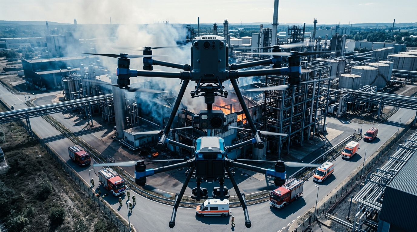
Automated fire drones provide the first crew with a life-saving situational overview even before the fire engine arrives. They launch within 25 seconds and consolidate their data clearly for the incident commander in manufacturer-independent dashboards.
Key Takeaways
- 1Automated drones arrive on average four minutes before the first emergency responders on site.
- 2They launch completely autonomously from docking stations within 25 seconds of the alarm.
- 3Thermal imaging cameras detect hidden fire pockets through dense smoke.
- 4Live images immediately transmit crucial details to the dispatch center and mobile tablets.
- 5With 23,760 volunteer fire departments in Germany, procurement requires tailored system comparisons.
The decisive advantage for the first crew
During structural fires and complex emergency incidents, the initial minutes following dispatch dictate firefighting success and victim survival. While statutory response times for fire services across most German states range between eight and ten minutes, critical time elapses during turnout, road transit, and initial foot reconnaissance. Automated fire drones stationed in weatherproof docking stations on firehouse rooftops or strategic urban facilities launch fully autonomously within 25 seconds of dispatch by the emergency operations center Drone as First Responder.
Operating via direct aerial flight paths, these uncrewed systems arrive at the incident scene approximately four minutes before ground-based emergency units. This temporal advantage provides the incident commander and the initial attack crew with an objective situational overview during transit. Critical hazards such as flashover risks in roof structures, blocked access routes, or trapped occupants at upper-floor windows are identified before the first fire engine arrives on scene.
- Reaction time: Automated launch from the docking station within 25 seconds of dispatch center alert
- Time advantage: Arrival at the incident scene an average of four minutes ahead of ground vehicles
- Dynamic initial reconnaissance: Automated 360-degree orbit around the structure for comprehensive visual assessment of all building facades
- Tactical advantage: Immediate determination of staging areas, aerial ladder positioning, and water supply points during transit
Instead of losing crucial minutes to manual perimeter reconnaissance on foot in accordance with standard fire service operating procedures such as FwDV 100, structured suppression operations commence immediately once the first crew dismounts. The incident commander can issue targeted operational orders without delay, substantially reducing risks for responding firefighters.
Building geometry and escape routes from above
Conventional ground-level reconnaissance faces physical limits when dealing with complex industrial buildings, dense residential layouts, or inner courtyards. An advance wedrone unit captures the complete building geometry from the air, delivering a high-resolution 360-degree aerial overview. Emergency forces immediately observe whether flames are propagating across flat roofs, light wells, or exterior facade insulation, and which escape routes remain accessible for building occupants.
Under heavy smoke conditions, integrated radiometric thermal imaging cameras deliver indispensable tactical clarity. They penetrate dense smoke plumes to detect concealed hot spots and heat accumulations beneath roof structures that remain undetectable from ground level. Simultaneously, thermal signatures of occupants trapped at windows, balconies, or roof terraces are pinpointed, enabling prioritized rescue operations via portable ladders or turntable ladder vehicles.
- Thermal localization: Pinpointing individuals at windows and balconies through thick smoke
- Structural hazard detection: Identifying burn-through risks on roofs, firewalls, and rooftop photovoltaic installations
- Optimized rescue corridors: Rapid identification of clear stairwells and secure access paths for attack teams
- Cross-referencing building plans: Direct alignment of live aerial video with digitized fire safety plans under DIN 14095
Transmitting precise coordinates to crew leaders prevents breathing apparatus teams from advancing into smoke-filled compartments where structural load-bearing capacity has already been compromised by ceiling fires.
Life-saving distance in unclear situations
During highway pileups or incidents involving hazardous materials (CBRN/Hazmat), aerial reconnaissance protects human life by maintaining safe standoff distances. In severe multi-vehicle collisions, the automated drone identifies traffic direction, the number of vehicles involved, and the full debris field while still approaching. Incident commanders determine early whether emergency corridors are blocked or if approaching units must access the site via the opposing carriageway.
In industrial and chemical fire scenarios, sending personnel close to the incident site for initial reconnaissance carries severe risks. High-resolution optical zoom cameras enable responders to read hazard warning placards (Kemler codes and UN numbers) on damaged tanker trucks from several hundred meters away. In addition, the drone provides vital information on smoke plume color, density, and dispersion direction, allowing exact calculation of evacuation zones and public safety warnings.
| Incident scenario | Tactical challenge | Drone-assisted solution |
|---|---|---|
| Motorway collision | Unclear access routes and blocked emergency lanes | Aerial imagery highlights open approach corridors and exact vehicle distribution |
| Hazardous materials (Hazmat) | High toxicity and explosion risks during close reconnaissance | Powerful optical zoom reads hazard placards from safe standoff distance |
| Structurally compromised buildings | Acute collapse risk for advancing crews due to debris | Thermal structural analysis uncovers cracks and weakened load-bearing members |
| Large-scale search and rescue | Impassable terrain across industrial parks or water bodies | Systematic thermal grid sweeps detect heat signatures in minutes |
Automated visual assessment prevents accidental entry into contaminated zones and safeguards firefighters from toxic fumes or sudden flash explosions.
Real-time data flow between dispatch and incident site
Aerial situational intelligence achieves its operational potential only when data latency is minimal and video streams are synchronized across all command levels. Modern systems broadcast encrypted live video feeds over LTE and 5G cellular networks simultaneously to the integrated dispatch center and mobile command tablets deployed on incident command vehicles and fire engines.
While command staff are still in transit, they analyze incoming visual feeds on mobile displays and designate tactical operational sectors. In parallel, dispatch coordinators can call in specialized CBRN advisers, heavy rescue equipment, or additional mutual-aid fire companies without waiting for the first verbal radio report from the scene. This eliminates critical information bottlenecks and standardizes tactical decision-making frameworks.
- Automated alarm dispatch: The central computer system alerts emergency responders and the corresponding drone docking station simultaneously.
- End-to-end encryption: Video and telemetry streams transmit with low latency across protected cellular data connections.
- Simultaneous situational display: Command officers in mobile units and dispatchers at the central station monitor the identical synchronized feed.
- Documentation and audit: Every flight is logged in an audit-proof archive with geospatial referencing and timestamps for post-incident analysis.
Complete operational documentation supports tactical commanding during the incident while providing verifiable datasets for post-incident review and cause investigations.
System-independent fleet control with Cockpit
Deploying uncrewed aerial systems at scale across regional fire jurisdictions requires vendor-agnostic management rather than isolated proprietary software silos. With Cockpit, operations commanders gain a centralized interface that manages multiple drone docks, sensor payloads, and automated flight paths within a unified dashboard.
The system features use-case-level traffic light indicators across four key operational dimensions: hardware health, infrastructure connectivity, regulatory status, and operational specification. This real-time oversight ensures that dispatchers immediately know whether a drone dock is clear for autonomous launch, battery levels are optimal, and airspace authorization is fully active.
- Hardware dimension: Real-time monitoring of battery charge state, motor telemetry, and camera gimbal calibration
- Infrastructure dimension: Live verification of LTE/5G network latency, dock weather sensor data, and roof hatch functionality
- Regulatory dimension: Automated validation of airspace clearances, NOTAM restrictions, and geographic geofencing boundaries
- Specification dimension: Tracking mission profiles, predefined flight corridors, and target sensor payload parameters
By centralizing fleet health and live mission monitoring into a single interface, command centers maintain rigorous operational control across municipal borders without requiring specialized pilot controls on every vehicle.
Needs-based procurement for every station
Establishing automated aerial reconnaissance across decentralized fire service structures presents substantial procurement complexities. In Germany alone, there are 23,760 volunteer fire departments alongside professional and industrial brigades, each operating under distinct municipal budgets, geographical response areas, and risk profiles. A rural brigade guarding vast forest reserves requires different sensor payloads and endurance capabilities than an urban department operating in high-density industrial zones.
Selecting suitable hardware is streamlined through Supplier Match, an OEM evaluation engine that scores and ranks over 44 drone manufacturers based on regulatory readiness, regional service coverage, integration footprint, and pricing tiers. Municipalities and fire authorities can objectively evaluate whether a turnkey dock system or a modular tactical platform best satisfies their local response requirements.
- Objective OEM scoring: Multi-criteria evaluation of drone manufacturers across hardware reliability and supply chain stability
- Service footprint analysis: Verification of local maintenance response times and spare part availability
- Integration compatibility: Evaluation of software compatibility with existing dispatch and command vehicle hardware stacks
- Budget alignment: Identification of hardware solutions that fit municipal fire protection development plans
Structured sourcing ensures that emergency response agencies invest in field-tested, compliant aerial infrastructure that integrates cleanly with existing command infrastructure rather than becoming stranded pilot hardware.
Distinction: Active deployment vs. forest fire watch
Integrating aerial technology into emergency response requires a clear tactical distinction between acute structural deployment and extended environmental surveillance. Active structure fires demand immediate, high-speed launches within seconds to deliver rapid perimeter assessment during the critical initial attack phase. In contrast, wide-area forest fire monitoring involves extended endurance flights, automated thermal waypoint scanning, and persistent patrol routes across broad woodland perimeters.
Both mission profiles require strict adherence to European aviation standards. Autonomous flights in populated areas or extended surveillance corridors operate under the BVLOS (Beyond Visual Line of Sight) framework within the Specific category of Commission Implementing Regulation (EU) 2019/947, utilizing SORA risk assessments and official public safety authority (BOS) exemptions.
- Acute emergency response: Rapid 25-second automated launch for immediate tactical reconnaissance at a localized incident site
- Forest fire surveillance: Prolonged BVLOS patrol routes for early wildfire detection and continuous thermal boundary tracking
- Regulatory compliance: Standardized operational approval under SORA and EU Drone Regulation 2019/947
- Integration middleware: Automated connection to command systems and dispatch centers via pre-built Connectors
The werob Platform coordinates this end-to-end integration lifecycle, combining Spec Engine for operational planning with secure middleware integration. This enables fire departments and public safety organizations to transition automated drone technology from isolated test flights into reliable, daily operational readiness.
Read more: wedrone Defense & public agencies · Drone networks for fire department control centers.
FAQ
- How much of a head start does a fire department drone provide?
- Pilot projects show that automated drones arrive at the scene on average four minutes ahead of the first responding crew. They launch from their docking station at the station within 25 seconds of the alarm.
- How does the drone assist with situational assessment of structure fires?
- The drone delivers a 360-degree aerial view of the fire building. Thanks to high-resolution thermal cameras, it can locate people at windows and reveal smoldering fires through dense smoke, enabling the crew to carry out a targeted rescue.
- Why isn't the incident commander tied to a specific drone app?
- Modern integration platforms such as the werob Cockpit consolidate video streams and telemetry data across manufacturers. This lets the commander keep full oversight of all systems in one unified dashboard, without switching between different applications.
- Are there nationwide standards for equipping fire departments with drones?
- No, needs vary widely. As a nationwide structural figure, Germany counted 23,760 volunteer fire departments and 114 professional fire departments as of 31 December 2023 (source: German Fire Brigade Association, DFV), with very different budgets. Tools such as Supplier Match help procurement teams filter for exactly the systems that match their specific requirement profile.
- Does the fire department drone replace reconnaissance by the crew leader?
- No, it complements it. The drone delivers valuable advance information on the extent of damage, escape routes, or hazardous materials. The final tactical decision on site remains with the incident commander, based on this improved situational picture.
Related reading
Fire department drone networks: Automatic launch on alarm
Discover how automated drone networks for fire departments provide real-time aerial intelligence before units arrive, leveraging BOS SORA exemptions.
17 August 2026missing person search drone thermalAerial Search for Missing Persons: What Thermal and Search Patterns Deliver
The drone finds nobody. It produces a lead that somebody on the ground has to check. What thermal imaging physically delivers, where it fails, and who holds the operating authorisation when volunteers fly.
1 September 2026environmental monitoring with drones air quality ecosystemsEnvironmental monitoring with drones: air quality, ecosystems and climate resilience
Learn how wedrone simplifies environmental monitoring with drones, enabling air quality tracking and ecosystem compliance under EU regulation 2019/947.
7 July 2026cloud seeding with drones enhancing precipitation to counterCloud Seeding with Drones: Sourcing and Managing Precision Weather Modification Operations
Discover how drone-enabled cloud seeding is integrated for drought response. Learn about EU drone regulation compliance and multi-partner operations.
7 July 2026power line and infrastructure inspection with dronesPower Line and Infrastructure Inspection with Drones: Thermography, BVLOS Corridors and Data Products
Learn how drone thermography and BVLOS corridors optimize power line inspections under EU regulation 2019/947, from planning to routine operations.
8 July 2026