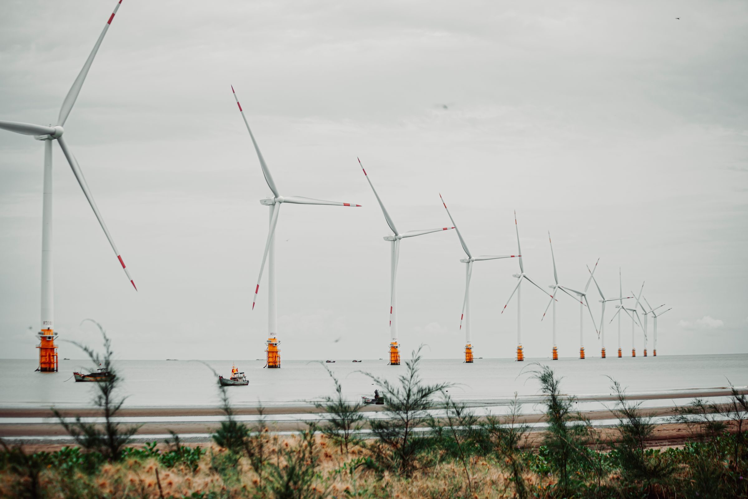
Offshore drone inspection: wind farms, platforms and the limits of flying over water
What drone inspection actually delivers offshore: the German wind stock in numbers, the regulatory frame after SORA 2.5, and the operational limits of flying without a landing option.
Offshore wind farms and substation platforms are inspected under conditions that do not forgive improvisation. There is no diversion field over water, weather and sea state open only narrow windows, and every surface carries salt. Drones are now a routine tool in that environment, but only inside a regulatory frame that has become noticeably more formal since SORA 2.5 became the binding means of compliance. wedrone is the drone unit of werob. It does not fly itself and holds no aviation certificates of its own. Flights are carried out by approved partner operators.
Key Takeaways
- 1As of 30 June 2026, 1,764 offshore wind turbines fed into the German grid with 10,818 MW across 31 fully commissioned wind farms (Deutsche WindGuard, published 21 July 2026).
- 2Mean water depth is 31 m and mean distance to shore is 73 km. Those two numbers shape inspection logistics more than the turbine count does.
- 3Since 29 September 2025, SORA 2.5 has been the binding AMC under Regulation (EU) 2019/947, with a quantitative iGRC model, ten steps and Detailed Operational Information in place of the former CONOPS.
- 4There is no PDRA for BVLOS over populated areas. Of 496 active BVLOS authorisations across 11 member states, only 89 are regarded as economically viable.
- 5A thermal or visual finding is an indication, not a diagnosis. The technical assessment of a blade or structural defect stays with the qualified surveyor.
- 6wedrone holds no aviation certificates and does not fly. Operations run through approved partner operators.
The German offshore stock and what it means for inspection logistics
Any inspection programme should be planned against the assets that actually stand in the water, not against a target curve. Deutsche WindGuard, in its report on the status of offshore wind expansion in Germany for the first half of 2026 (published 21 July 2026), counts 1,764 turbines feeding into the grid with 10,818 MW as of 30 June 2026, distributed across 31 fully commissioned wind farms. Including turbines not yet feeding in, 1,786 units stand offshore, plus 65 foundations that carry no turbine yet. In the North Sea the figure is 8,987 MW across 1,455 turbines, in the Baltic 1,831 MW across 309 turbines. The statutory expansion targets under the WindSeeG remain in force, but WindGuard itself considers the 2030 target no longer achievable in the time available, so it is not a sound basis for capacity planning.
Two figures from the same report matter far more for inspection work than installed capacity: the mean water depth of 31 m and the mean distance to shore of 73 km. Seventy-three kilometres means that no inspection is a day trip from a pier with a car and a case. It means vessel time, crew transfer, a berth, and a weather forecast that has to hold for the full transit and the full working window. Since 2019, every German project has used monopile foundations, which keeps the structural geometry above and below the waterline comparatively uniform across the fleet.
Against that background, the traditional approach of rope access for blade and tower inspection carries an obvious cost structure. Technicians work at height above open water, inside the same narrow weather windows, with a mobilisation chain that starts days before the first metre of rope is deployed. Aerial capture does not remove the vessel or the weather window, but it compresses the time an asset has to be stopped and it removes people from the rope.
- Shorter standstill per turbine, because a structured sensor sweep replaces a manual descent.
- Fewer people working at height above water, which is the single largest risk item in the classical method.
- Repeatable flight paths, which is the precondition for comparing one campaign against the next.
- A consistent image and metadata format that can be filed against the asset record rather than a technician's notes.
An overview of how wedrone structures such campaigns with approved partner operators is available on the wedrone offshore page.
What a drone captures, and what it does not decide
The sensor payload on an offshore inspection flight is usually a high resolution optical camera, frequently combined with a thermal camera. What that combination produces is a dense, geometrically ordered set of observations of surfaces that are otherwise reachable only by rope or platform. Typical findings on rotor blades and support structures include leading edge erosion from rain and salt at high tip speeds, coating damage and cracking along the blade shell, condition of lightning receptors, and corrosion at flanges, bolt connections, ladders and boat landings on the tower and transition piece.
Thermography adds a second layer. Temperature differentials across a composite surface can point to areas where the internal structure differs from its surroundings, for example in the region of a bond line. That is where the honest limit of the method sits: a thermal anomaly is an indication, not a diagnosis. Surface temperature depends on solar loading, the time since the rotor stopped, wind, humidity and the emissivity of the coating. Whether an anomaly corresponds to delamination, a repair patch, a moisture inclusion or nothing at all is a question that a qualified surveyor answers, using the imagery together with the maintenance history and, where necessary, a close inspection on the structure itself.
This distinction is not a formality. The certificate, the classification of the finding and the repair decision remain with the responsible expert and the operator's own engineering function. Aerial capture changes the frequency and the completeness of the input, not the chain of responsibility. For the same reason, published detection rates and accuracy percentages should be treated with care: they depend on the defect class, the surface, the light and the flight geometry, and a figure taken from one campaign rarely transfers to another.
- Capture: imagery and thermal data, geometrically referenced to the blade or structure.
- Screening: sorting the material and flagging areas that deviate from the previous campaign.
- Assessment: classification and severity rating by the qualified surveyor.
- Decision: repair planning, scheduling and documentation by the operator.
Why flying offshore is harder than flying onshore
The operational difficulty offshore is not the flight itself. It is everything around the flight. Four constraints dominate.
There is no diversion field. Over water, every emergency procedure that onshore would end in a controlled landing on a field or a road has to end somewhere else: on the deck it launched from, on a platform, or not at all. An aircraft that goes into the water is in practice lost, together with its payload and, more importantly, its data if that data was not already downlinked. This single fact drives redundancy requirements, payload choices and the design of the lost link procedure far more than any regulatory text.
Launch and recovery frequently happen from a moving deck. A vessel on station still heaves, rolls and pitches, and it generates its own turbulent wake around the superstructure. Take-off and landing procedures have to account for deck motion, for the relative wind over the deck, and for the fact that the reference point itself is moving. This has to be agreed with the master and the deck crew before the campaign, not negotiated on the day.
Salt is corrosive and it is everywhere. Spray reaches airframes, connectors, motor bearings and optical surfaces. Rinsing and drying protocols after each flight day, sealed connectors and adequate ingress protection are maintenance basics offshore, not optional extras. Equipment that performs well in an inland quarry may degrade quickly in a marine atmosphere.
The window is narrow. Wind speed limits the aircraft, sea state limits the vessel and the transfer, and both have to be inside their respective limits at the same time for long enough to complete the planned work. In practice the sea state constraint on crew transfer and deck operations often closes the window before the wind constraint on the aircraft does.
- Lost link over water: the fallback has to be a defined, rehearsed return or hold procedure with a realistic energy reserve, not a generic return-to-home point.
- Large steel structures and high current cabling distort magnetic heading references, so navigation cannot rely on a single compass source.
- Data should be secured continuously during the flight where the link allows, because a recovered aircraft is not guaranteed.
- Every deck operation needs a documented interface with vessel operations, including stop criteria.
The regulatory frame: 2019/947, 2019/945 and SORA 2.5
European drone operations are governed by two instruments. Implementing Regulation (EU) 2019/947 covers the operation, with the three categories open, specific and certified. Delegated Regulation (EU) 2019/945 covers the equipment, including class marking and the requirements on manufacturers and importers. Offshore inspection work, in particular anything beyond visual line of sight, sits in the specific category.
The decisive change for anyone planning such operations came on 29 September 2025, when SORA version 2.5 became the binding acceptable means of compliance through ED Decision 2025/018/R. Version 2.5 is not a cosmetic update of 2.0. The ground risk determination moved to a quantitative iGRC model based on population density and the characteristics of the aircraft rather than a coarse table. The process is structured in ten steps, and the former CONOPS was replaced by Detailed Operational Information, which is a more prescriptive description of what the applicant has to submit. Applications and operational manuals written against SORA 2.0 need to be reworked, not merely re-dated.
Two frequent misconceptions are worth correcting. First, there is no PDRA for BVLOS over populated areas. The set of predefined risk assessments remains S01, S02, G01, G02 and G03, and none of them covers that case, so such operations require a full assessment. Second, FAA Part 108 is not in force; it exists as a proposed rule and cannot be cited as an available route for BVLOS operations.
In Germany, operational authorisations in the specific category are issued by the Luftfahrt-Bundesamt. Processing time depends on the complexity of the case, the maturity of the submission and the mitigations claimed, and no meaningful blanket figure can be given. Beyond the aviation authorisation, offshore work requires coordination with maritime traffic management and with the wind farm operator's own permit-to-work system.
On the airspace side, the U-space framework consists of Regulations (EU) 2021/664, 2021/665 and 2021/666, applicable since 26 January 2023. Adoption in practice is still thin: San Salvo in the Abruzzo region is the first and so far only fully certified operational U-space airspace in the European Union. The economic picture is similarly sober. Across 11 member states there are 496 active BVLOS authorisations, of which only 89 are regarded as economically viable. That ratio is the most useful available indicator of how far the gap still runs between a permit on paper and a service that pays for itself.
Operating from vessels and platforms: who does what
An offshore inspection campaign involves at least four parties: the asset operator, the vessel or platform operator, the approved aviation operator holding the authorisation, and whoever integrates the resulting data into the maintenance process. Confusion about that division of roles is a more common source of failed campaigns than any technical shortcoming.
wedrone does not fly. It holds no operational authorisation, no operator certificate and no LUC. It specifies the mission, sources suitable equipment on a manufacturer-independent basis, matches the requirement to approved partner operators who hold the necessary authorisations, and organises the flow of data back into the operator's systems. The aviation responsibility, the operations manual, the SORA submission and the accountable manager sit with the partner operator. That separation is stated explicitly because in this field it is often blurred, and a blurred line becomes a liability question at the worst possible moment.
- Vessel interface: agreed flight windows with the master, defined deck areas, stop criteria for wind, sea state and vessel manoeuvring, and a radio protocol that does not compete with bridge traffic.
- Aviation interface: the partner operator's authorisation, crew qualification and emergency procedures, checked against the specific site rather than assumed.
- Asset interface: permit to work, turbine stop and rotor position where required, and lockout arrangements with the wind farm control room.
- Data interface: agreed formats, naming against the asset register, and a defined recipient for the assessment on the operator's side.
Where marine class work is involved, for example on vessels or floating units rather than fixed wind structures, the relevant recognition route runs through the classification societies. Remote inspection techniques are described in IACS Recommendation No. 42, and the approval of service suppliers is governed by IACS UR Z17, whose Section 16 covers RIT providers. DNV's own service supplier approval scheme is DNV-CP-0484. Recognition as a service supplier, not the choice of aircraft, is the actual market entry barrier in that segment.
From imagery to a maintenance decision
A campaign across a wind farm produces a large volume of imagery, and volume alone creates no value. The value is created when the material is comparable across time and when the findings arrive in the system where maintenance is actually planned.
Comparability is a question of flight discipline. Two campaigns flown to the same profile, with the same standoff distance, the same overlap and comparable lighting, can be set against each other and the differences interpreted. Two campaigns flown differently produce two independent picture sets, and the apparent changes between them may be artefacts of geometry rather than of the structure. Defining and freezing the flight profile before the first campaign is therefore worth more than any subsequent processing step.
The second requirement is unglamorous: every image needs to be unambiguously attributable to an asset, a component and a position, using the operator's own identifiers rather than a folder structure invented by whoever flew that day. Once that holds, the findings can be transferred into the maintenance planning system as work items, and the reporting question of how the fleet is developing over several years becomes answerable.
werob approaches this as a manufacturer-independent systems integrator: specifying the requirement, selecting equipment across vendors rather than within one product line, and arranging the interfaces so that operators are not tied to a single supplier's ecosystem for their inspection history. An overview of the equipment categories in use is available in the robot catalogue.
Below the waterline, and how to procure the whole picture
An aerial campaign stops at the waterline. Everything below it, scour protection at the monopile, the condition of the transition piece in the splash zone, the marine growth, the cable entry and the cable protection system, is outside the reach of any drone. That work belongs to underwater robotics, and with a mean water depth of 31 m across the German stock, the regular case does not require a work class system or a DP2 vessel: an observation ROV rated to a few hundred metres covers the entire installed German offshore wind fleet. The corresponding capability sits with werob under subsea robotics, and what ROV and AUV inspection realistically delivers today is set out in a separate article on subsea inspection.
Read together, the two halves give the sensible procurement view. The asset is one structure from the blade tip to the seabed, and it is inspected by two different technologies under two different regulatory regimes. Aerial work is governed by aviation law and stands or falls on the operational authorisation of the flying party. Underwater work is governed by class and by the recognition of service suppliers. Bundling both under one specification and one data model avoids the situation where the same structure carries two incompatible condition histories.
- Specify against the condition information required, not against a particular aircraft or vehicle model.
- Fix the flight and dive profiles first, because repeatability is what makes campaigns comparable.
- Check the partner operator's authorisation against the actual operation, including BVLOS, night operations and the launch site.
- Keep the assessment of findings with the qualified surveyor and document that boundary in the contract.
- Retain the raw data and the metadata, because the value of a baseline only appears in the second and third campaign.
Similar mechanics apply in other industrial environments where drones fly under the same rules but face very different site constraints, as described for surface mining operations.
FAQ
- Which regulations govern offshore drone inspection in Europe?
- Operations are governed by Implementing Regulation (EU) 2019/947 and, for the equipment, by Delegated Regulation (EU) 2019/945. Offshore inspection, especially beyond visual line of sight, falls into the specific category and requires an operational authorisation, in Germany from the Luftfahrt-Bundesamt. Since 29 September 2025 the binding means of compliance for the risk assessment is SORA version 2.5 under ED Decision 2025/018/R.
- What changed with SORA 2.5 compared with SORA 2.0?
- Version 2.5 introduces a quantitative iGRC model for ground risk instead of a coarse table, structures the process in ten steps, and replaces the CONOPS with Detailed Operational Information. Existing applications and operations manuals written against version 2.0 have to be reworked rather than simply resubmitted.
- Is there a standard scenario or PDRA for BVLOS over populated areas?
- No. The existing predefined risk assessments are S01, S02, G01, G02 and G03, and none of them covers BVLOS over populated areas. Such operations require a full risk assessment and an individual operational authorisation.
- How much offshore wind capacity is currently installed in Germany?
- According to Deutsche WindGuard, as of 30 June 2026 there were 1,764 offshore wind turbines feeding into the grid with 10,818 MW, spread across 31 fully commissioned wind farms. Including turbines not yet feeding in, 1,786 units stand offshore, plus 65 foundations without a turbine. Mean water depth is 31 m and mean distance to shore is 73 km.
- Can a thermal image confirm a blade defect?
- No. A thermal anomaly is an indication, not a diagnosis. Surface temperature depends on solar loading, wind, humidity, the time since the rotor stopped and the coating. Classification and severity assessment of a blade or structural finding remain with the qualified surveyor.
- Can drones be launched from offshore service vessels?
- Yes, and in practice this is often the only option. It requires procedures for deck motion and relative wind, agreed flight windows with the master, defined stop criteria, and a lost link procedure that works over water, since an aircraft that ditches is in practice lost. The flight is carried out by an approved partner operator holding the relevant authorisation.
- Does wedrone hold its own aviation certificates?
- No. wedrone is the drone unit of werob, does not fly itself and holds no operational authorisation, operator certificate or LUC. It specifies the mission, sources equipment on a manufacturer-independent basis and coordinates approved partner operators, who carry the aviation responsibility.
Related reading
Drones in surface mining: stockpile survey, blast monitoring and settling basins
What drone surveying actually delivers in quarries and open pits: stockpile volumes, highwall mapping, blast monitoring and settling basins, and where the responsibility of the mine surveyor begins.
24 July 2026subsea robotics rov auv inspectionSubsea robotics: what ROV and AUV inspection delivers today
German offshore wind sits in 31 m of water on average. That single figure decides which underwater vehicle, which vessel and which approval an inspection campaign really needs.
22 July 2026counter drone systems explained c uav detection defenseCounter-Drone Systems Explained: C-UAV Detection & Defense
Discover how C-UAV and C-UAS systems protect airspace through advanced detection, tracking, and mitigation technologies to secure critical infrastructure.
6 August 2026offshore wind maintenance turbine access costOffshore Wind Maintenance: The Real Cost of Turbine Access
1,764 offshore wind turbines with roughly 10.8 GW stand in German waters. Every maintenance job starts with the same question: how does someone reach the turbine safely without burning a weather window.
18 September 2026drone bridge inspectionDrone-based bridge inspection: reaching the soffit without a closure
Learn how drone bridge inspection accesses soffits and bearings under DIN 1076 without closures, helping overcome construction skilled worker shortages.
17 July 2026