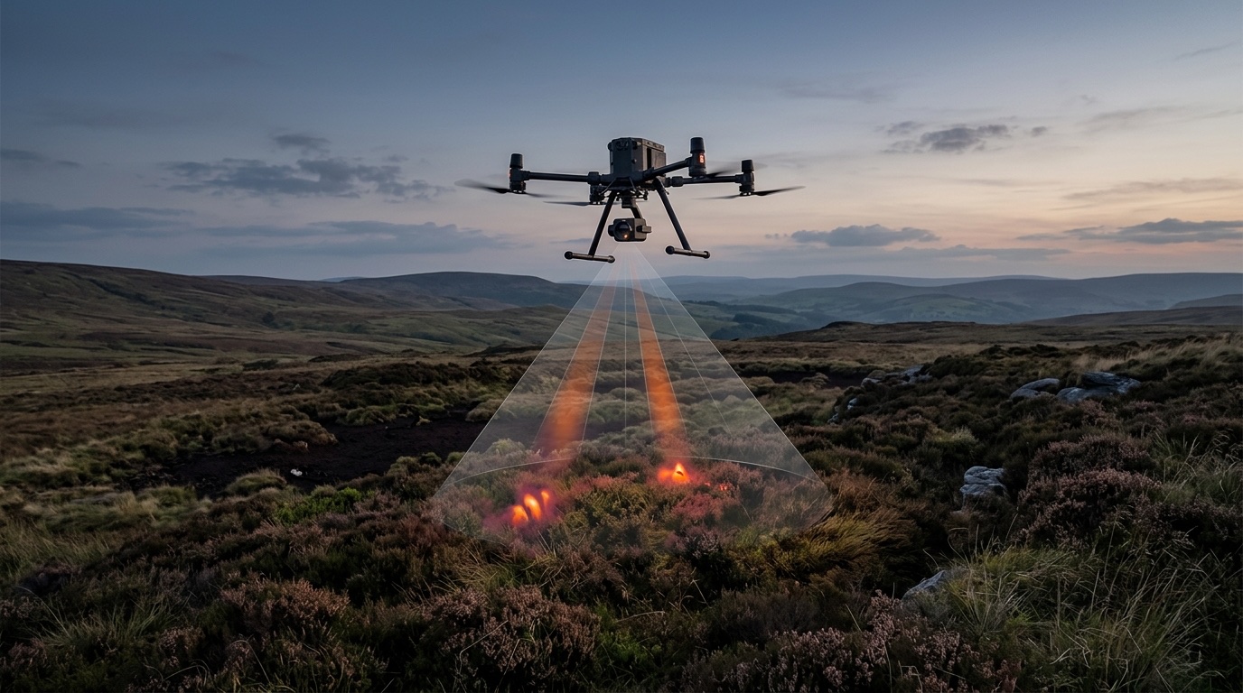
Aerial Search for Missing Persons: What Thermal and Search Patterns Deliver
The drone finds nobody. It produces a lead that somebody on the ground has to check. What thermal imaging physically delivers, where it fails, and who holds the operating authorisation when volunteers fly.
An aerial search for a missing person turns on a single question: is there a person at this position? Not who that person is. That distinction governs sensor choice, altitude, search pattern and legal basis — and it determines what an operator must have set down in writing before the first launch.
Key Takeaways
- 1A thermal sensor detects temperature contrast, not people. What matters is the difference between body surface and background, not sensor resolution (Burke et al., Drones 2019, 3, 78).
- 2Detection, recognition and identification are separate performance levels under the DRI model; the maximum operating altitude follows from the meteorological conditions measured on site (Medić et al., Drones 2024, 8, 76).
- 3Raw thermal imagery does not see through a closed canopy. The published workaround is computational — airborne optical sectioning (Schedl, Kurmi and Bimber, Science Robotics 6(55), 2021) — and is not a standard payload.
- 4Altitude and search pattern govern area rate and probability of detection more than the sensor does: pixels on target fall with the square of the altitude.
- 5§ 21k LuftVO exempts only authorities and organisations with security tasks from the authorisation required under Article 12 of Implementing Regulation (EU) 2019/947. Outside that frame, the flying organisation needs its own operating authorisation.
Detection is not identification: the distinction up front
Before any discussion of sensors comes a distinction that shapes the entire deployment. A missing-person search sets out to establish that there is a person at a position. Who that person is does not matter to the search task — that resolves itself on the ground when the team arrives. This is not a formality. It is the reason a search drone is configured differently, flown differently and documented differently from a reconnaissance flight.
The thermal literature uses the DRI model for exactly this gradation: detection, recognition, identification. In their maritime search pilot study (Drones 2024, 8, 76), Medić, Bakota, Jelaska and Škorput determine these parameters by measurement and derive from them the drone's maximum operating altitude under the atmospheric and maritime conditions recorded on site. For a missing-person search, only the lowest level counts in practice. A person-sized heat source at a plausible position is enough to send a ground team.
For the operator this has a sober procurement consequence. A powerful optical zoom that resolves faces or number plates does not improve search performance. It adds weight, cost and justification burden towards the data protection authority without changing detection range. Everything aimed at identification — zoom onto people, plate capture, biometric matching — belongs to a different deployment on a different legal basis. How that looks in a policing context is treated separately in the article on aerial reconnaissance in active operations; this text stays with the search.
What thermal imaging physically delivers
A thermal sensor does not measure people. It measures radiometric temperature differences between surfaces. Whether a person lying on the ground stands out in the image therefore depends first on the contrast between body surface and background — and only after that on the equipment rendering that contrast.
Burke, McWhirter, Veitch-Michaelis, McAree, Pointon, Wich and Longmore examined this in a pilot study in Morecambe Bay (Drones 2019, 3, 78). Across a range of realistic search scenarios they were able to detect humans who would genuinely have been in need of rescue, both by the naked eye and with a simple automated method — while also setting out the limitations of such systems. That double finding is the useful part for operators: the method works, but it works conditionally.
The first condition is thermal contrast, and contrast is a property of the scene, not of the device. On a clear night the ground radiates heat away and cools while the body stays warm: contrast is at its maximum. In the afternoon, solar loading heats rock, asphalt, roof surfaces and dry vegetation to temperatures that reach or exceed skin temperature. Contrast collapses or inverts. Thermal search is therefore primarily a night and twilight instrument, and the time window belongs in the operational plan rather than in the after-action review.
The second condition is pure geometry. Sensor resolution, focal length and altitude fix how many centimetres of ground fall on one pixel. From that follows how many pixels a person lying on the ground occupies at all — and a person reduced to two pixels is no longer a target but noise. Because ground sampling distance grows linearly with altitude, the pixel area on target falls with the square of it: fly twice as high and you have a quarter of the pixels on the person.
Where thermal fails: daytime heat, canopy, wet ground, standing water
Four conditions reliably degrade a thermal search. An operator who does not name them in advance is selling the incident commander an expectation the equipment cannot meet.
Daytime heat. Solar radiation loads the ground thermally. With enough heating the person disappears into the warm background, or the background becomes hotter than they are. A search flight at three in the afternoon over sunlit rock or stubble field returns systematically worse results than the same flight three hours after sunset.
Canopy. A thermal sensor needs a line of sight. Closed deciduous canopy interrupts it; what gets through are gaps between branches, not a view through the foliage. That Schedl, Kurmi and Bimber had to develop a dedicated method for this problem — airborne optical sectioning, a synthetic aperture technique that computationally integrates many slightly offset thermal captures, published in Science Robotics 6(55), 2021 — is itself the best evidence that an off-the-shelf thermal payload does not do it. The technique is research, not a catalogue option. Searching over woodland means planning around gaps, tracks, firebreaks and forest edges, not around seeing through.
Wet ground and wet clothing. Evaporation cools. Soaked clothing lowers the person's radiating surface temperature, and damp ground evens out temperature differences. After rain, contrast is smaller in both directions.
Standing water. Water has a high heat capacity and a very uniform surface temperature. The contrast of a partly immersed body against that surface is low — this is the core of the study by Medić et al. (Drones 2024, 8, 76), which treats the case at sea, with and without a survival suit, explicitly as a low-contrast problem. For searches along banks, ponds and flooded ground this means the thermal image is the weaker tool there, not the stronger one.
Altitude and search pattern decide more than the sensor
Two variables govern the outcome of a search flight more than any purchasing decision: the altitude flown and the pattern flown. Both are planning variables, and both belong on paper before launch.
Altitude sits in a hard trade-off. Flying higher means covering a wider swath, so more area per hour — and at the same time fewer pixels on target, so a lower probability of detection per pass. No better sensor resolves that trade-off; it only shifts it. Medić et al. accordingly derive the admissible ceiling from conditions actually measured rather than from a datasheet figure: the maximum useful operating altitude is a property of the particular evening on which you fly.
For the pattern itself an established vocabulary has existed for decades. The IAMSAR Manual issued by ICAO and IMO describes, among others, the parallel sweep, the expanding square and the sector search. Their conditions of use are clearly separated: the parallel sweep covers a large area uniformly when the location is unknown. The expanding square suits a position known within relatively close limits and gives nearly uniform coverage around the datum. The sector search comes into consideration when the position is accurately known and the area is small. A drone changes none of this logic — it is one more search facility inside the same frame.
In practice this means the search area, the altitude, the track spacing, the ground speed and the heading relative to sun and wind are decisions documented before launch. Track spacing must be sized to the field of view of the thermal camera, not to the wider field of view of the RGB camera on the same gimbal; otherwise unflown strips appear in the record as searched ground. That separation between recorded and actual coverage is precisely the point at which a search later becomes auditable, or does not.
The false-positive problem: who triages a hit
Every person-sized heat source produces a hit. Deer and wild boar do it, grazing livestock too, along with sun-heated boulders, compost heaps, transformer stations, parked vehicles with a warm engine, flue outlets and heat pumps. In a real search area the number of candidates is considerably larger than the number of people being sought — and it rises the more sensitively the analysis is set.
From this follows an organisational question rather than a technical one: who looks at a hit, how quickly, and what happens to the aircraft in the meantime? In practice this is not the remote pilot. Whoever flies the pattern, holds the altitude and watches the airspace cannot simultaneously assess imagery with any concentration. A second seat at the screen is therefore not a comfort feature but the precondition for the area search continuing while a candidate is checked.
For the incident commander the limiting resource is not the drone anyway, but the ground team. An analysis that lowers the threshold so as to miss nothing produces more leads than the team can work through and pins it to positions that turn out to be deer. An analysis that raises the threshold misses people. The defensible setting is a decision for the incident commander, not for the sensor manufacturer — and it belongs on record with its reasoning.
From the integrator's seat this is a documentation matter. What has to be fixed: who triages, on what criterion the decision is made, which hit is logged with timestamp and coordinate, and how that log stays auditable afterwards. Why auditable flight logs weigh more in procurement than capability claims is set out in the article on onboard drone autonomy, and applies here unchanged.
From aerial report to ground team: the handover
A drone rescues nobody. It produces a report, and the value of that report is decided by how quickly and how losslessly it reaches the team on the ground. The transition from air to ground is where searches fail in practice — not at the sensor.
A usable report consists of a coordinate, a time and the image that triggered it. The format is decisive: the coordinate has to arrive in the reference system and the notation that the ground team's device actually processes. A position that has to be converted or retyped on the ground costs minutes and introduces transcription errors. Equally part of it is what the aircraft does after a hit. Holding over the position with the navigation light on gives the approaching team a visual marker, but interrupts the area search. Whether that is right in a given case is for the incident commander to decide — that it must be settled beforehand is for the operator.
The second point concerns connection to the existing command organisation: which system does the coordinate land in, does the incident commander see the same image as the analysis seat, and who enters the report on the situation map? These questions are identical to those raised by fire service drones used for situational awareness, and they are solved in the same place: in the organisational integration, not in the payload.
What happens next lies outside the flight. Access, first aid, transport — that is the team's task. The aerial component has made its contribution once a checked position is available in time and undistorted.
Who holds the operating authorisation when a volunteer organisation flies
The most common misconception in this field is that search and rescue is generally exempt from European aviation law. The exemption exists, but it is tied to a condition that has to be read closely. Article 2(3)(a) of Regulation (EU) 2018/1139 removes from the scope aircraft, together with the personnel and organisations involved, while carrying out “military, customs, police, search and rescue, firefighting, border control, coastguard or similar activities or services” — but only insofar as that activity is “under the control and responsibility of a Member State, undertaken in the public interest by or on behalf of a body vested with the powers of a public authority”. The exemption therefore does not hang on the purpose of the flight but on its public-authority footing.
Nationally, § 21k LuftVO connects to this. Its first paragraph provides that no authorisation under Article 12 of Implementing Regulation (EU) 2019/947 is required for the operation of unmanned aircraft below 25 kilograms take-off mass by or under the supervision of, first, authorities where the operation takes place in fulfilment of their tasks and, second, organisations with security tasks in connection with emergencies, accidents and disasters. Its third paragraph additionally exempts these bodies from the direct remote identification requirement insofar as the use serves the fulfilment of their statutory tasks. The Saxon State Office for Road Construction and Transport points out that the Federal Ministry for Digital and Transport has expressly restricted the application of § 21k LuftVO to authorities and organisations with security tasks (BOS) — and that without that status, the corresponding permissions from the competent aviation authority are mandatory.
For a volunteer-run organisation, then, the decisive variable is not its legal form but the footing of the specific flight. A search flight requested by the control centre in an emergency stands differently from an exercise, a self-initiated deployment without a request, or standby operations. Where a flight does not fall under § 21k, the regular route applies: classification in the specific category and an operating authorisation under Article 12 of Implementing Regulation (EU) 2019/947, with the risk assessment under SORA 2.5, which EASA brought into the AMC and GM to that regulation with ED Decision 2025/018/R of 29 September 2025. That authorisation path itself is described in the article on the drone service operating model and is not repeated here; what BOS forces are actually permitted to do on deployment is covered in the article on the legal rules for first responders.
What the operator settles before procurement
Everything above produces a procurement document concerned less with equipment than with decisions. Five points should be in writing before hardware is selected.
First, the operating window. Under which conditions — time of day, cloud cover, ground surface, rainfall in the preceding hours — does the system deliver usable contrast at all, and under which does it not? That statement belongs in the control centre's deployment documentation, so that a request which is hopeless is never triggered in the first place.
Second, the flight parameters as a fixed decision. Altitude, track spacing and pattern are documented before launch, with track spacing sized to the thermal camera's field of view. Only then can searched ground be distinguished afterwards from merely overflown ground.
Third, the analysis seat. Triaging hits is a role of its own, with its own screen, its own decision criterion and its own logging duty — not an additional task for the remote pilot.
Fourth, the interface downwards. The coordinate format the ground forces actually process is a hard system requirement, not a downstream configuration. Part of it is settling what the aircraft does after a hit.
Fifth, the legal basis per type of flight. For deployment, exercise and standby it must be established separately whether § 21k LuftVO applies or an operating authorisation is required — before the first unit is ordered, not at the first callout.
wedrone is a manufacturer-independent systems integrator; it neither holds the operating authorisation nor conducts the search. Both remain with the organisation that flies. The integrator's contribution is to force these five decisions before procurement — and to hold the expectation of the method to what it actually delivers under the conditions of the particular night.
FAQ
- Can a thermal camera find a missing person through dense woodland?
- Not through a closed canopy. A thermal sensor needs a line of sight; only what radiates through gaps between branches and leaves becomes visible. For this problem Schedl, Kurmi and Bimber developed a computational method, airborne optical sectioning (Science Robotics 6(55), 2021), which integrates many slightly offset captures. That is research, not an off-the-shelf payload. In practice, woodland searches are planned along gaps, tracks and forest edges.
- Why is night better than day for a thermal search?
- Because the sensor measures temperature contrast, not people. At night the ground cools by radiating heat away while the body stays warm, so contrast is at its maximum. During the day the sun heats rock, asphalt and dry vegetation to temperatures at or above skin temperature, which makes contrast collapse or invert.
- Which search patterns apply to a drone search flight?
- The same ones the IAMSAR Manual of ICAO and IMO describes for aerial search: the parallel sweep for large areas with an unknown location, the expanding square where the position is known within relatively close limits, and the sector search where the position is accurately known and the area is small. The drone is one more search facility inside that frame, not a method of its own.
- Who checks whether a thermal hit is actually a person?
- Not the remote pilot. Whoever is responsible for pattern, altitude and airspace cannot assess imagery with concentration at the same time. What is needed is a second, staffed analysis seat plus a decision rule fixed in advance for when a candidate is passed to the ground team and how it is logged. The limiting resource is the ground team, not the aircraft.
- Does a volunteer aid organisation need its own operating authorisation for search flights?
- That depends on the specific flight, not on the legal form. § 21k(1) LuftVO exempts operations below 25 kilograms take-off mass by or under the supervision of authorities, and of organisations with security tasks in connection with emergencies, accidents and disasters, from the authorisation required under Article 12 of Implementing Regulation (EU) 2019/947. The Federal Ministry for Digital and Transport has expressly restricted its application to authorities and organisations with security tasks. Where a flight — an exercise, say, or a deployment without a request — does not fall under it, an operating authorisation from the competent aviation authority is required.
Related reading
Drone Reconnaissance: Legal Rules for First Responders
Learn the legal rules for BOS drone aerial reconnaissance, including sovereign operation exemptions, geozone flights, SORA 2.5, and strict GDPR requirements.
17 August 2026drone as a service the operating model thatDrone-as-a-Service: the operating model that turns drone pilots into routine programs
Discover how Drone-as-a-Service converts manual pilots into routine programs. Scale your operations legally under EU regulation 2019/947 with wedrone.
7 July 2026onboard drone autonomyOnboard Drone Autonomy: What Changes for Operators
The question is not whether the aircraft can fly itself. It is what you have to be able to show once it does — indoors, on containment, on link loss, and in procurement.
31 August 2026police drone deploymentDrones for police: aerial reconnaissance in active operations
Learn how police drones support manhunts, traffic accident recording, and major events, and how they are operationally controlled during active deployments.
17 August 2026fire department dronesFire drones: situational awareness for the first crew
Fire department drones provide the first crew with life-saving situational overviews. Learn how automated reconnaissance secures real time advantages.
17 August 2026