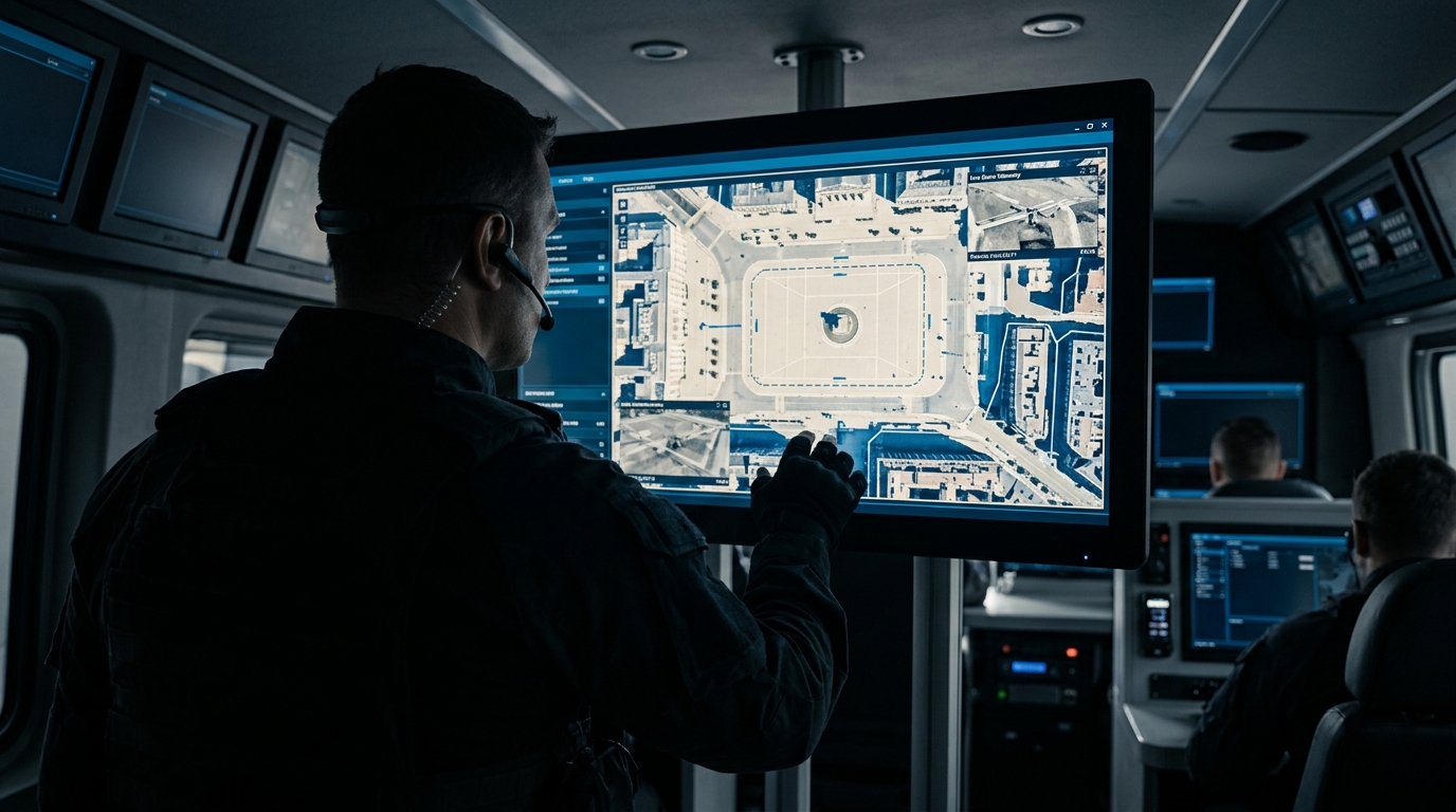
Drones for police: aerial reconnaissance in active operations
Learn how police drones support manhunts, traffic accident recording, and major events, and how they are operationally controlled during active deployments.
Police drones accelerate missing persons searches, secure crime scenes, and provide commanders with a precise situational overview. For legally compliant and efficient operations, authorities require tailored hardware and centralized fleet management.
Key Takeaways
- 1Drones enable rapid aerial reconnaissance for missing person searches at altitudes up to 120 meters.
- 2Millimeter-precise 3D measurement of crime scenes significantly reduces ground personnel effort.
- 3The EU Drone Regulation 2019/947 has regulated the legal framework for flight operations since 2021.
- 4wedrone acts as a system integrator and aligns hardware with specifications via Supplier Match.
Operational Aerial Reconnaissance: The Tactical Value
For incident commanders in state police forces, federal police, and municipal public order agencies, the speed of information gathering directly determines the success of an operation. Critical incidents during major events, complex crime scenes, or missing person searches demand an immediate aerial perspective. Targeted police drone deployments close the operational gap between ground patrol units and the resource-intensive dispatch of manned police helicopters.
Real-Time Situational Assessment Complementing Helicopters
While manned helicopter squadrons require considerable lead times for takeoff and approach alongside substantial operating costs per flight hour, compact unmanned aircraft systems (UAS) can be carried directly in patrol vehicle boots. Within minutes of arriving on scene, the system feeds high-resolution live video to mobile command posts. Official pilot initiatives show that manageable budgets suffice to equip multiple police stations with an aerial capability: the Bavarian Police pilot project with supplementary multicopter systems cost around 75,000 euros and ran for approximately one year.
- Immediate on-site availability within three to five minutes of arrival
- Substantial reduction in operating expenses compared to manned flight hours
- Reconnaissance in confined urban spaces and forested areas below the cloud base
- Safe perimeter inspection during hazardous material incidents, fires, or armed threat scenarios
Drone technology does not replace helicopters in every scenario, but it has established itself as an essential tool for initial tactical assessment. It enables incident commanders to dispatch ground units with precision and evaluate risks to officers before entering hazardous areas.
Saving Lives and Manhunts: Searches from the Air
In time-critical operations such as searching for individuals at risk of suicide, disoriented seniors, or fleeing suspects, every minute counts. Expansive wooded areas, embankments, or rough agricultural terrain tie down extensive ground personnel and slow search chains considerably.
Thermal Sensor Technology and Maximum Area Coverage
Modern emergency response drones combine high-resolution RGB cameras with radiometric thermal sensors. In the open category, flight operations are restricted to 120 meters above ground level; within this boundary, large operational areas can be scanned systematically. Thermal signatures stand out clearly against cooler backgrounds, even in dense vegetation or total darkness. Once a suspicious heat source is detected, high-powered optical zoom allows identification from a safe distance without startling the person or dispatching responders into unmapped terrain prematurely.
| Sensor Type | Primary Tactical Application | Range / Detail Detection |
|---|---|---|
| Radiometric Thermal Camera | Night-time missing person searches, heat signature detection in dense vegetation | Human detection at several hundred meters distance |
| High-Resolution RGB Camera with Hybrid Zoom | Suspect manhunts, identification of getaway vehicles and license plates | Optical detail magnification even from maximum permitted flight altitude |
| Integrated Laser Rangefinder | Precise coordinate extraction to guide tactical intervention teams | Accurate geopositioning with minimal deviation |
Transmitting GPS coordinates of spotted persons directly to digital command and control systems minimizes response times. Combining rapid localization with precise positioning saves lives in hypothermia scenarios and substantially increases apprehension rates during suspect manhunts.
Precise Documentation: Accident Recording and Crime Scenes
Court-admissible forensic preservation following severe traffic accidents or major crimes requires complete, true-to-scale documentation. Conventional methods such as manual measuring tapes, measuring wheels, or terrestrial laser scanners often take hours and lead to prolonged full closures of motorways and federal highways.
Photogrammetry and Three-Dimensional Crime Scene Modeling
Using automated photogrammetric grid flights, drones capture the entire accident scene from multiple angles and elevations. From these overlapping images, specialized software calculates point clouds, digital terrain models, and high-resolution orthophotos that enable true-to-scale reconstruction of the incident.
- Substantial reduction of closure times on federal motorways and arterial transit corridors
- Complete preservation of forensic trace evidence prior to weather degradation or scene clearance
- Generation of scaled 3D models for forensic expert testimony and court proceedings
- Enhanced workplace safety for accident investigation teams away from flowing traffic
The resulting 3D models allow forensic experts and investigating judges to virtually adopt the line of sight of involved parties or measure skid marks to the millimeter months after the event. The on-site time required for trace preservation decreases from several hours to just minutes.
Dynamic Situation Overview at Major Events
Public assemblies, demonstration marches, and high-risk sports matches present incident commanders with complex logistical challenges. Dynamic crowds move quickly through urban street corridors, while barricades, bottlenecks, or sudden obstructions remain difficult to assess from ground level.
Guiding Ground Units and Countering Unauthorized Drones
From the air, drones provide sector commanders with a continuous overview of spectator flows, density dynamics, and potential detour routes. This allows cordon positions to be adjusted early and police units positioned proactively before congestion turns into hazardous crowd crush situations. Simultaneously, onboard sensors monitor surrounding airspace for hazards from unauthorized civilian drones. Unpermitted flights over public gatherings or within temporary restricted airspace endanger participants, violate aviation safety rules, and can trigger substantial fines under current drone defense regulations.
Visual aerial reconnaissance protects both peaceful assembly participants and deployed officers by enabling police measures to target specific agitators without impacting the wider crowd.
Legal Guardrails: EU Drone Regulation 2019/947
Public authority UAS operations operate within a clearly structured regulatory framework. Commission Implementing Regulation (EU) 2019/947 harmonizes the rules for unmanned civil aviation across the European Union, classifying operations into open, specific, and certified categories.
Operational Exemptions for Public Safety Agencies and Beyond Visual Line of Sight
While standard civil drone operations are subject to strict distance rules and mandatory certifications, authorities and organizations with safety tasks (BOS) benefit from statutory exemptions in specific emergency contexts. Nonetheless, standardized documentation and compliance remain critical for risk mitigation and accountability. Operations exceeding standard visual line of sight (VLOS) or involving complex urban perimeters frequently transition into structured Specific Operations Risk Assessment (SORA) workflows, aligning with broader frameworks established for BVLOS approval across critical public services.
- Open Category: Low-risk operations within visual line of sight up to 120 meters above ground level
- Specific Category: Medium-risk operations, including BVLOS flights and flights over populated areas requiring operational declarations or SORA authorisations
- Certified Category: High-risk operations involving passenger transport or hazardous cargo requiring full airworthiness certification
Structured compliance management ensures that police forces maintain operational readiness while meeting strict aviation oversight and personal data protection standards under GDPR.
Vendor-Independent Hardware: The Supplier Match
Selecting the right UAS airframe and sensor suite for police operations requires balancing flight endurance, payload capacity, optical zoom performance, environmental ingress protection, and data security standards. Procurement departments face a rapidly shifting market of commercial and tactical hardware vendors.
Matching Operational Specs Against Certified Drone OEMs
Through the vendor-independent Supplier Match engine, operational requirements are mapped directly against technical specifications and regulatory readiness scores across leading drone manufacturers. Rather than relying on closed single-vendor ecosystems, public safety agencies can identify hardware configurations optimized for their precise operational scenarios, whether for urban tactical response, forensic photogrammetry, or long-range search missions.
- Evaluation of payload compatibility across dual thermal and radiometric optical camera gimbals
- Assessment of operational weather limits, IP ratings, and wind resistance for all-weather deployment
- Verification of data security compliance, onboard encryption, and sovereign server architecture
- Analysis of regional maintenance networks and replacement parts availability to minimize fleet downtime
This structured sourcing methodology ensures that law enforcement fleets deploy resilient, future-proof hardware tailored to public safety specifications.
Fleet Management by wedrone: Spec Engine and Cockpit
Operating a multi-station police drone fleet demands more than reliable hardware; it requires structured operational planning, fleetwide maintenance tracking, and unified software integration. The dedicated wedrone platform acts as an end-to-end system integrator, helping public safety authorities transition from isolated pilot units to scalable, routine aerial operations.
Automating Deployment Specs and Centralized Operational Monitoring
With the Spec Engine, operational profiles and mission parameters are translated into structured, compliant deployment plans. The Cockpit dashboard then provides command staff with a centralized, real-time interface covering hardware readiness, maintenance cycles, pilot qualification statuses, and regulatory documentation across the entire deployed UAS fleet.
- Spec Engine: Fast translation of plain-language deployment scenarios into formally structured operational plans
- Cockpit Dashboard: Central fleet overview with traffic-light status tracking across hardware, maintenance, and compliance dimensions
- Audit-Proof Logging: Automated flight and mission records for forensic transparency and administrative compliance
- Seamless Integration: Standardized software connectors to bridge UAS video streams into existing emergency response dispatch systems
By uniting manufacturer-agnostic hardware selection with centralized operational software, wedrone equips law enforcement agencies with a dependable foundation for routine aerial reconnaissance.
Read more: wedrone Defense & public agencies · What's legally deployable for first responders today.
FAQ
- What operational tasks does a police drone take on?
- It supports officers in missing-person searches, evidence preservation at crime scenes, traffic accident documentation, and delivers a fast aerial picture at large public events.
- How high may a drone fly during a police operation?
- To protect general airspace, operation in the open category is limited to 120 meters above ground.
- What legal framework applies to police aerial reconnaissance?
- The basis is the EU Drone Regulation 2019/947, which has applied Europe-wide since 2021 and divides operations into the open, specific, and certified categories. It also defines the requirements for flights beyond visual line of sight (BVLOS). Specific BOS special rights are addressed separately.
- What does it cost to set up an agency drone fleet?
- Costs depend on the hardware specification. The Bavarian police's pilot trial with additional multicopter systems, for example, was budgeted at around 75,000 euros.
- How does police handle disruptive private drones?
- If private pilots disrupt the airspace over an incident scene or a large event, the flight is not permitted under aviation law and can be prosecuted as a regulatory offense. Police detect such aircraft, identify the operator, and stop the flight.
- What role does wedrone play in procurement?
- As a manufacturer-independent systems integrator, wedrone does not build its own drones. Instead, Supplier Match is used to select the optimal hardware for the police operational profile from a broad partner network.
Related reading
Drone Reconnaissance: Legal Rules for First Responders
Learn the legal rules for BOS drone aerial reconnaissance, including sovereign operation exemptions, geozone flights, SORA 2.5, and strict GDPR requirements.
17 August 2026police control center drone networkPolice drone networks: A live picture within minutes
Drone networks for police control centers provide immediate aerial situational pictures. Learn about BOS rights, SORA exemptions, and system integration.
17 August 2026missing person search drone thermalAerial Search for Missing Persons: What Thermal and Search Patterns Deliver
The drone finds nobody. It produces a lead that somebody on the ground has to check. What thermal imaging physically delivers, where it fails, and who holds the operating authorisation when volunteers fly.
1 September 2026cloud seeding with drones enhancing precipitation to counterCloud Seeding with Drones: Sourcing and Managing Precision Weather Modification Operations
Discover how drone-enabled cloud seeding is integrated for drought response. Learn about EU drone regulation compliance and multi-partner operations.
7 July 2026vehicle-launched drone operationsLaunching drones from a vehicle: line of sight, the operating site, and the containment that travels
The fixed box on the fence is well understood. The other case is the crew that arrives in a van, stays two hours and drives on. For them there is no hangar, no fixed operating site, and no containment that stays put.
2 September 2026