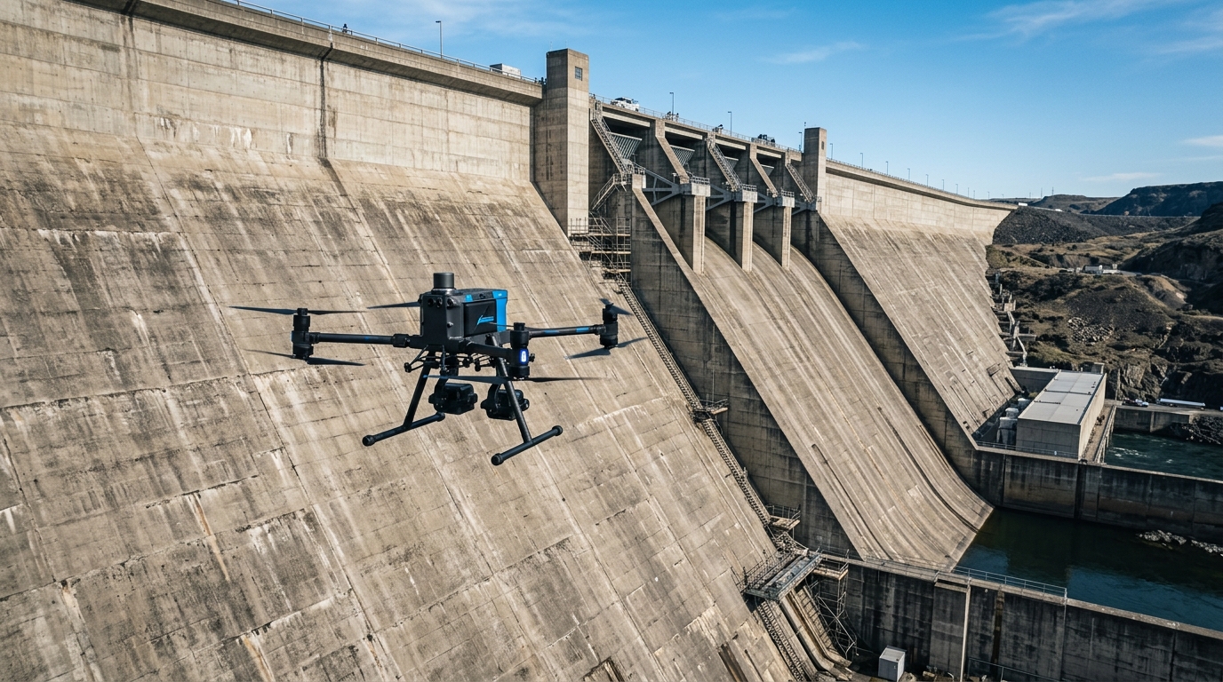
Monitoring dams and reservoirs from the air: deformation and seepage over time
Learn how the wedrone platform standardizes multi-pass aerial monitoring to detect structural deformation and dam seepage over time with millimeter precision.
Regular aerial monitoring is crucial for dam safety. Through the wedrone system, part of the werob platform, operators can standardize multi-pass drone surveys to compare structural deformation, seepage, and vegetation growth over time with sub-millimeter precision.
Key Takeaways
- 1Germany faces a critical skilled-worker shortage, highlighting the necessity of automated aerial inspection.
- 2The wedrone system captures high-resolution imagery to detect surface concrete cracks and structural displacement.
- 3Using RTK GNSS and automated flight paths ensures precise multi-pass survey repeatability to directly compare physical structural shifts over time.
- 4Integrated thermal infrared and multispectral sensors map surface temperature anomalies and vegetation growth to pinpoint hidden water seepage.
The Scale of Infrastructure and the Inspection Labor Bottleneck
Maintaining critical infrastructure across Germany requires managing vast systems under severe labor constraints. The public network includes thousands of bridges alongside an extensive extra-high-voltage electricity grid. Simultaneously, construction companies face a forecast skilled-worker shortage. For dam operators and reservoir asset managers, these realities reflect a broader challenge: traditional, manual structural monitoring is no longer scalable. To safeguard these critical water retaining facilities, operators must pivot toward structured digital workflows and automation strategies that decouple inspection frequency from on-site labor availability.
- The dam crest, where alignment and elevation changes indicate settling or structural shifts.
- The downstream face, where emerging wet spots or changes in vegetation density can indicate internal seepage.
- The visible concrete or masonry structure, where superficial crack development requires continuous, millimeter-level tracking over time.
As a manufacturer-independent robot integrator, werob addresses this bottleneck through its specialized wedrone unit. Working alongside partner networks, wedrone coordinates regular aerial capture of these zones without taking over the physical operation of the asset. This approach focuses exclusively on standardized, multi-pass data collection, capturing the dam crest, downstream face, and primary structural elements with identical flight paths and angles. By treating the drone as a structured sensor deployment tool, the system ensures that deformation, thermal seepage signatures, and vegetation variations remain directly comparable from one inspection pass to the next. This regular, partner-supported capture converts manual, high-risk surveying tasks into a reliable, repeatable stream of operational data, keeping asset safety ahead of the growing labor deficit.
Standardizing Aerial Surveys for Dams and Reservoirs
Regular visual monitoring of large-scale hydraulic structures under regulatory frameworks such as DIN 19700 requires continuous and precise inspections of the dam crest, structural concrete or masonry, and the downstream face. Historically, these assessments relied on high-risk manual inspections, where workers descended on suspended platforms or scaffolding to spot millimeter-scale fissures. Uncrewed aerial systems offer a safe, non-contact alternative. Through the wedrone platform, operators can deploy standardized aerial survey missions that capture structural data without any physical contact, ensuring complete safety without disrupting active reservoir or turbine operations.
As a manufacturer-independent systems integrator, werob does not manufacture drone hardware or operate the assets directly. Instead, werob coordinates with specialized flight partners to execute automated aerial missions using the optimal payload for each environment. The critical value of this approach lies in cross-pass repeatability: standardizing flight paths, sensor angles, and altitude ensures that data remains comparable across multi-year cycles. This precise, repeatable capture is essential for tracking structural deformation, spotting thermal signatures of internal seepage, and evaluating downstream vegetation changes over time.
- Dam Crest: Routine high-resolution mapping to detect horizontal or vertical alignment shifts.
- Downstream Face: Visual and thermal imaging to identify structural cracks and monitor localized moisture indicating seepage.
- Surrounding Slopes and Vegetation: Vegetation health monitoring to spot hidden water outflows or erosion patterns that could compromise stability.
By removing human inspectors from hazardous high-altitude environments and replacing manual efforts with automated, partner-executed aerial surveys, infrastructure operators secure a reliable baseline of high-precision data. This integration of advanced aerial technology into standard maintenance schedules transforms dam safety from a reactive check into a highly predictable, standardized routine.
High-Resolution Payloads: Sub-Millimeter GSD and Sensors
Achieving high-fidelity monitoring of massive concrete structures and embankments requires professional, survey-grade metric sensors rather than standard consumer equipment. To detect minuscule structural changes, aerial drone surveys managed by wedrone deliver a ground sampling distance (GSD) as fine as 0.5 mm when operating approximately 20 meters from the dam face. This sub-millimeter resolution allows engineering teams to identify hairline cracks, surface weathering, and micro-deformation before they develop into critical structural defects.
To establish highly accurate concrete and earth topography, high-resolution photogrammetric cameras are paired directly with onboard LiDAR-based rangefinders and real-time kinematic (RTK) GNSS systems. This sensor integration is essential for maintaining a constant distance from the complex, convex geometry of a dam wall, especially when navigating unpredictable alpine crosswinds. The combination of LiDAR and high-megapixel imaging ensures that every pass captures perfectly focused, orthorectified imagery that remains directly comparable over monthly or annual inspection cycles.
- Metric imaging sensors: High-megapixel cameras that capture fine surface anomalies with rapid trigger intervals.
- Onboard LiDAR rangefinders: Active distance-measuring systems to maintain precise flight offsets from the curved dam face.
- RTK GNSS positioning: Centimeter-level spatial accuracy to ensure repeatable flight paths across successive inspection passes.
- Onboard processing storage: Terabyte-class high-speed storage capable of handling massive raw imagery payloads.
Selecting the optimal combination of these highly specialized sensors is a key step in deploying an effective monitoring program. As a manufacturer-independent robot integrator, the werob platform does not lock operators into a single brand of hardware. Instead, werob uses its Supplier Match engine to analyze a broad graph of equipment providers, scoring and ranking options based on regulatory readiness, regional service coverage, and the precise payload requirements of the dam facility. This approach ensures that every aerial deployment is both technically optimal and fully compliant with local aviation and industrial safety regulations.
Achieving Multi-Pass Comparability: Repeatable Flight Paths
To monitor structural changes over time, successive aerial flights must capture data under identical spatial parameters. Operating as a manufacturer-independent systems integrator, werob deploys the wedrone platform to standardize these surveys without binding operators to proprietary drone hardware. The capture workflows focus strictly on the aerial side of dams and reservoirs, regularly scanning the concrete structure, crest, and downstream face. Asset operators retain full control over water and infrastructure management, as the drone workflows are limited strictly to automated data capture executed in tandem with specialized partners.
Achieving this level of consistency requires Real-Time Kinematic (RTK) GNSS technology. An RTK-equipped drone connects to a base station or reference network to correct GPS signals in real time, determining precise spatial coordinates with centimeter-level accuracy. This precise georeferencing enables autonomous waypoint navigation, guiding the drone along identical flight vectors across separate passes to ensure that images from different dates align perfectly.
Furthermore, achieving absolute multi-pass comparability depends on combining digital flight path repetition with physical ground references:
- Permanent Ground Control Points: Installing permanent physical Ground Control Points (GCPs) on stable rock formations near the reservoir ensures absolute geometric consistency during subsequent photogrammetric reconstruction.
- Identical Camera Angles: Programming precise waypoint trajectories ensures that the camera captures the crest and downstream face from identical perspectives on every flight.
- Comparable Pass-to-Pass Mapping: Standardizing these parameters allows software to compare high-resolution imagery and accurately detect minor structural deformations, thermal signs of seepage, and vegetation changes.
By combining high-precision RTK waypoint navigation with permanent physical GCPs, the platform makes multi-temporal data sets directly comparable. Engineering and maintenance teams can confidently detect millimeter-level trends over months or years, transforming routine aerial scans into an objective foundation for preventative dam safety.
Monitoring Structural Deformation and Joint Displacements
Monitoring the physical integrity of large dams and reservoirs requires continuous, high-precision observation of the structural concrete, the crest, and the downstream face. Traditionally, capturing millimeter-level shifts required manual inspection or asset shutdowns. Through the managed wedrone platform, operators can deploy regular, multi-pass aerial drone surveys without disrupting daily operations. As a manufacturer-independent robot integrator, werob partners with specialized flight providers to execute these complex captures, standardizing the raw data pipelines so that structural deformation, thermal seepage, and vegetation overgrowth become directly comparable across consecutive passes.
To track microscopic movements over multiple inspection cycles, sequential photogrammetric processing and LiDAR point clouds are transformed into dense 3D models. Advanced change-detection algorithms then compare these multi-temporal datasets to isolate millimeter-level deformations, surface cracks, and expansion joint displacements. This standardized comparison ensures that structural shifts are caught early, even amidst a forecasted skilled-worker shortage which constrains traditional engineering workforces. By focusing solely on data capture rather than active asset operation, the system establishes a quantitative safety baseline while civil engineers remain safely on the ground.
- Structural alignment: Millimeter-level tracking of concrete deformation along the crest and downstream face.
- Joint displacement: Measurement of opening, closing, or shearing of expansion joints over sequential seasons.
- Surface anomalies: Early identification of developing concrete cracks and surface spalling before structural failure occurs.
- Environmental indicators: Regular comparison of thermal seepage patterns and vegetation encroachment across identical flight paths.
Because these aerial surveys are repeatable and sensor-agnostic, asset managers receive consistent data regardless of the drone hardware used during the flight. This hardware independence allows the werob platform to adjust to new imaging technologies as they emerge, maintaining a reliable, long-term historical record of the dam's physical state.
Detecting Seepage Patterns via Thermal and Multispectral Imaging
Early-stage seepage within earthen and concrete barriers often remains invisible to the naked eye. Cooler reservoir water seeping through structures creates subtle temperature field anomalies that can be identified via thermal infrared thermograms. Combined with multispectral imaging, particularly the Normalized Difference Vegetation Index (NDVI), operators can track abnormal vegetation growth on the downstream face triggered by localized soil moisture. Studies demonstrate that integrating thermal infrared and NDVI analysis can achieve a success rate of up to 93 percent in identifying water-leak anomalies.
To capture these indicators before they escalate into structural failures, the wedrone system, integrated via the manufacturer-independent werob Platform, standardizes multi-pass aerial drone surveys. Operated in collaboration with specialized payload partners, this service focuses exclusively on the non-intrusive aerial capture of the dam crest, downstream face, and overall structure. Crucially, the deployment does not involve active asset operations, focusing purely on precise, repeatable data capture.
- Thermal thermograms: Mapping temperature discrepancies on the downstream face and concrete-to-soil interfaces to isolate cooler water seepage paths.
- Vegetation index tracking: Using NDVI to pinpoint localized moisture patches where abnormally dense plant growth indicates persistent moisture.
- Structural deformation baselines: Combining multi-pass orthomosaics to capture changes in the crest alignment and structural concrete barriers over time.
All captured data feeds directly into the unified Cockpit dashboard. Rather than managing disparate sensor outputs, dam operators and infrastructure civil engineers view unified, use-case-level traffic lights. This system translates raw thermal anomalies and vegetation shifts into clear structural risk indicators, ensuring that comparative physical data remains accessible and actionable over years of routine monitoring.
Integrating Aerial Intelligence: The werob Platform and Cockpit
Consolidating multi-pass aerial data is the core challenge in long-term infrastructure surveillance. As a manufacturer-independent systems integrator, werob standardizes these processes through its wedrone unit on the unified werob Platform. By standardizing aerial survey workflows across various drone models, the platform ensures that visual and thermal data from the dam crest, structure, and downstream face remain directly comparable across multiple years. This consistency is vital for identifying millimeter-scale structural deformation, pinpointing thermal seepage anomalies, and mapping downstream vegetation changes that signal water leakage.
To achieve this repeatability without vendor lock-in, the Spec Engine translates the operator’s plain-language inspection requirements into formally verified, ROS-compatible deployment plans within 48 hours. This allows operators to define strict flight boundaries, capture intervals, and thermal sensor specifications. Because the resulting action graphs are standardized, any authorized flight partner can execute the inspection, guaranteeing that subsequent passes capture the exact same coordinates and angles.
- Geometric Consistency: Locks flight trajectories and sensor standoff distances to ensure millimeter-precision deformation analysis over time.
- Continuous Diagnostics: Merges optical and thermal datasets to correlate structural cracks with subsurface seepage patterns.
- Compliance Tracking: Verifies that every partner flight meets safety and regulatory requirements before data is accepted.
Following execution by regional flight partners, the entire data-capture cycle is monitored via the Cockpit dashboard. The Cockpit provides real-time traffic lights across hardware, regulatory, and specification dimensions to verify data quality and partner tasks. Once verified, pre-built Connectors automatically feed these structural health insights directly into the operator's existing asset management systems and operational databases. This eliminates manual data handling, enabling immediate engineering decisions while maintaining a comprehensive, audit-logged history of the asset's structural evolution.
FAQ
- How does aerial monitoring help detect structural deformation in dams?
- By capturing high-resolution metric imagery and LiDAR data over repeatable flight paths, photogrammetry algorithms construct highly accurate 3D models. These models compare structural surface data over successive passes, detecting surface displacements, concrete cracks, and joint movements with millimeter-level precision without requiring high-risk manual platforms.
- Can thermal cameras detect water seepage in concrete or earthen dams?
- Yes. Thermal infrared sensors map the surface temperature field of the dam's downstream face. Because seeping water from the reservoir has a different temperature than the surrounding structure, it creates distinct thermal anomalies. Automated algorithms identify these thermogram patterns to pinpoint leak locations.
- What role does vegetation tracking play in dam safety?
- Abnormal or localized vegetation growth on the downstream face is often an early biological indicator of hidden water seepage. By using multispectral sensors to calculate moisture and vegetation indices like NDVI alongside thermal imaging, operators can pinpoint seepage locations that are invisible to the naked eye.
- How does wedrone ensure drone survey data is comparable over multiple passes?
- Wedrone ensures multi-pass comparability by utilizing RTK GNSS for centimeter-level flight path repeatability, permanent ground control points (GCPs), and standardized camera angles. This strict repeatability allows automated analytical software to perform pixel-to-pixel comparisons of deformation and vegetation.
- Does werob manufacture the drones used for reservoir inspections?
- No, werob is a manufacturer-independent robot and drone integrator, not a hardware manufacturer. Through the werob Platform, we match asset operators with specialized service partners and optimal hardware, managing the entire specification, monitoring, and database integration workflow via Cockpit and Connectors.
Related reading
Drone dike inspection: from the single flight to a programme
Coverage, repeatability and an evidence trail — not sharper eyes. What operators must set up to turn drone flights over flood defences into a running inspection programme.
28 August 2026onboard drone autonomyOnboard Drone Autonomy: What Changes for Operators
The question is not whether the aircraft can fly itself. It is what you have to be able to show once it does — indoors, on containment, on link loss, and in procurement.
31 August 2026drone bridge inspectionDrone-based bridge inspection: reaching the soffit without a closure
Learn how drone bridge inspection accesses soffits and bearings under DIN 1076 without closures, helping overcome construction skilled worker shortages.
17 July 2026offshore drone inspection wind turbineOffshore drone inspection: wind farms, platforms and the limits of flying over water
What drone inspection actually delivers offshore: the German wind stock in numbers, the regulatory frame after SORA 2.5, and the operational limits of flying without a landing option.
24 July 2026aerial reconnaissance droneDrone Reconnaissance: Legal Rules for First Responders
Learn the legal rules for BOS drone aerial reconnaissance, including sovereign operation exemptions, geozone flights, SORA 2.5, and strict GDPR requirements.
17 August 2026